Since I retired back in ’09, I’ve done a lot of walking. Most of it has been around my town of Benicia, California, but my favorite walks have been all-day walks in the city (we call nearby San Francisco, “the city”) or the east bay. I would do such long walks once or twice per month. On my walks I carry a backpack with some sandwiches, an umbrella, warm vest, water proof jacket, a few medical supplies, a 10 amp-hour power brick (AKA a 10,000ma brick), and sometimes a laptop.
I started out doing these long walks by walking from one BART station in the city to another BART station. Then if I felt good enough, I’d continue on to yet another BART station, and so on. Eventually, I was walking from the furthest BART station (Millbrae) back to the furthest BART station in the other direction (Embarcadero). Then I tried stuff like taking a ferry to Sausalito or Larkspur and walking back to a BART station in the city. Then I just wanted to walk from one city to another city, so I did Berkeley to Concord, then Richmond to Concord, Fremont to Berkeley, Hayward to Walnut Creek., Orinda to North Concord, Dublin to North Concord, Dublin to Berkeley, Fremont to Millbrae, San Bruno to Pacifica to the city, etc. These walks were 20-30 miles long. Since 2019 most of those walks have been 15-20 miles. I guess I am slowing down in my old age.
I always record my walks with my iPhone walkmeter app. I found that the app stores the walks (seemingly forever) in a “Meter.db” sqlite file. I played around with perl to extract data from that file. I figured out how GoogleEarth “kml” files are formatted. So I used perl scripts to create kml files showing the paths that I had walked. It’s very cool to be able to zoom in and see every little nook and cranny where I’ve been on foot. Below are some screenshots of those paths, but they don’t show how cool it is to zoom in and out and fly over the areas where I’ve walked.
I would love to be able to create a movie of a fly-over of these Google Earth maps. I guess that might be a future project.
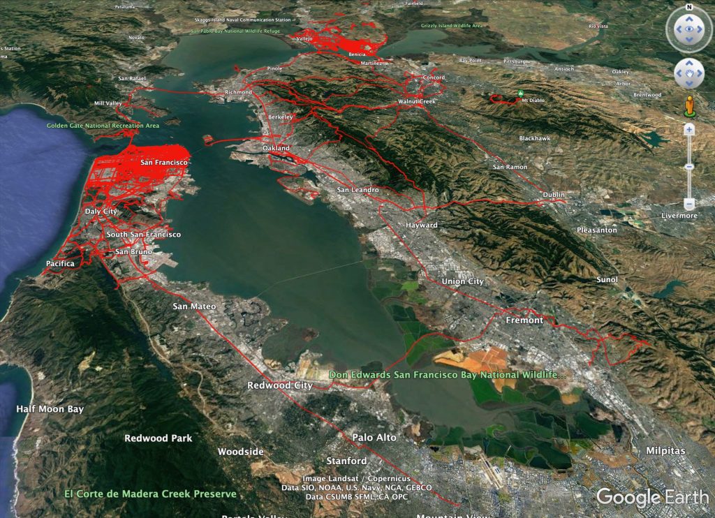
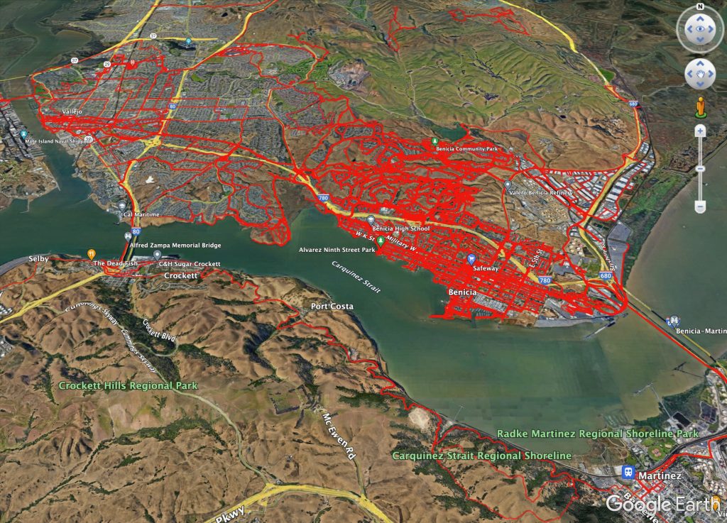
2023-05-23 Looking at these walking paths maps is really cool if/when you’re looking at them in Google Earth and when you zoom in and out. The more you zoom in, the more you can see the individual paths. It’s also possible to “fly” from one spot to another. I’ve only done that once. It was a bit of a struggle to figure out how to do it, but I hope to try it again one of these days and maybe record the screen and make a little video out of it.